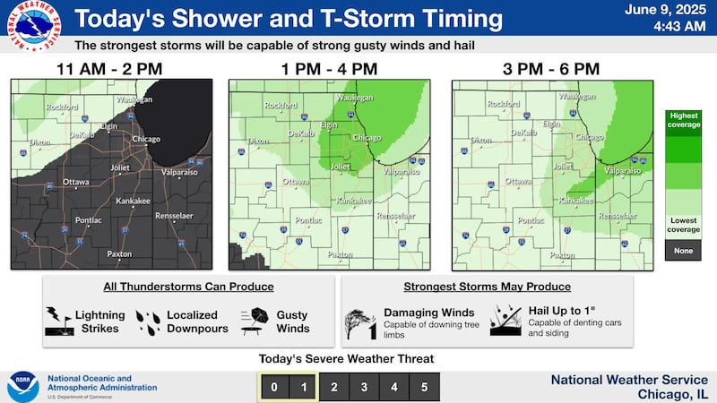
Northern Illinois could see scattered thunderstorms Monday, with the strongest storms capable of producing gusty winds and hail up to an inch in diameter, according to the National Weather Service.
Storms are most likely between 1 and 6 p.m., with the highest coverage expected in and around Joliet, Elgin and Waukegan. Areas farther west, such as DeKalb, Dixon and Ottawa, may see only isolated activity earlier in the afternoon.
NWS warns that all thunderstorms today could bring frequent lightning, brief heavy downpours and gusty winds. A few stronger storms may cause localized wind damage, particularly to tree limbs. The risk of severe weather is classified as Level 1 out of 5, indicating marginal potential.
As of early Monday, no severe thunderstorm watches or warnings had been issued, but NWS advised residents to stay weather-aware throughout the day, particularly during afternoon outdoor activities or commutes.
The unsettled weather is expected to clear out by this evening, with drier conditions returning overnight. Tuesday’s forecast calls for mostly sunny skies and highs in the upper 70s to low 80s.
For the latest forecast and any alerts, visit weather.gov/lot.
:quality(70)/author-service-images-prod-us-east-1.publishing.aws.arc.pub/shawmedia/59fc2deb-4690-4608-b846-d6af698839c4.png)