Scattered thunderstorms forecasted for Friday evening could bring large hail, damaging winds and perhaps a tornado, the National Weather Service warned.
The agency issued a hazardous weather outlook for McHenry, Lake, Ogle, Lee, DeKalb, Kane, DuPage, La Salle, Kendall, Grundy, Kankakee, Will and Cook counties early Friday morning.
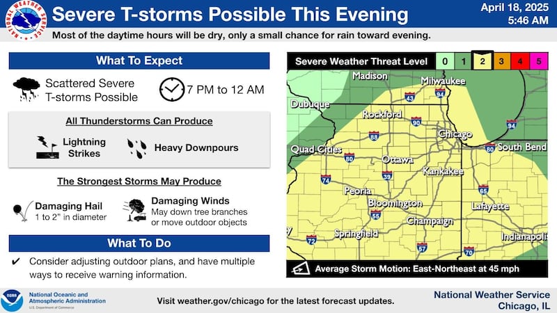
The outlook forecasts potentially severe thunderstorms to cross the region Friday evening with the greatest threat being hail of possibly up to 2 inches in diameter.
The greatest risk is estimated between 7 p.m. and midnight, the National Weather Service said on X, formerly known as Twitter.
The potential also exists for locally damaging winds of up to 60 mph and perhaps a tornado, especially if thunderstorms become more widespread and are able to organize into a line, according to the outlook.
The storms will come as a cold front follows a day featuring temperatures reaching the 80s.
More warm weather is expected next week as well, along with a limited risk of thunderstorms returning on Sunday and Tuesday, the agency said.
:quality(70)/s3.amazonaws.com/arc-authors/shawmedia/816e96b9-8582-47c5-84fd-a268095b4ce2.png)